ADVERTISEMENT
River - Haiti Observer Blog
River, Haiti Observer Blog. Read the following articles about River
River Macassia
Considered to be one of the best sites for outdoor adventures or fishing throughout the regions of Western Europe and the Americas, Haiti's River Macassia can be found by water enthusiasts at the coordinates of 18.933333 and -71.866667. For those not so well versed in degrees of latitude and longitude, the rivers inclusion on many adventure maps allows for them to use a simple printout as their guide to many water adventures.
Another river of great note in Haiti is the Artibonite River. It starts in the Dominican Republic, in the mountains of Cordillera Central, the same range where many rivers on the island of Hispaniola get their start. It then flows down into Haiti. On its course through the smaller portion of Hispaniola, it flows, having most of its journey coursed through Haiti, before it then empties itself into the Gulf of Gonâve.
Minister of Agriculture, Thomas Jacques, monitoring work at Riviere Grise
Departmental Director of the West, Mr. Arnoux Severin and Minister of Agriculture, Mr. Thomas Jacques together went on a monitoring survey of the gabionade and clearing works in Rivière Grise. The purpose of the visit by the two Agricultural Engineers was to monitor the work progress.
The overall project has an estimated cost of 62 million gourdes which will come from the state government treasury. The work spans over an area of length 6.3 km. This project will go through three major bridges which include Tabarre Bridge, Croix-des-Missions Bridge and Duvivier Bridge. The work will end at Duvivier Bridge. The Duvivier Bridge is located in the Cité Soleil town. The estimated time frame for the entire work has been calculated to be 3 months.
Port-A-Piment and The River That Runs Through
The town of Port-a-Piment in the Sud Department is one the municipalities where the Rivieres de Port a Piment goes through. There are about 13,900 people living in Port-a-Piment and they get affected when the river overflows. It is common for the river to cause floods during the rainy season. When it happens, the dirt roads become submerged, making it impossible for people to use them. Roads are often closed down when the river overflows.
It can be recalled that in 2011, two people were reported to have been swept away when the river overflowed. Around 70 families in the villages of Chantal and Corteaux were also affected by the disaster, which destroyed their homes. During that time, people were forced to relocate.
The Town of Lascahobas in Haiti

Lascahobas, situated amid the Central Plateau of Haiti, is a second-tier administrative division, and the Lascahobas Arrondissement capital. It has a population of 41,716 and sits one hour westward from the Haiti-Dominican Republic border. Three sub-divisions make up Lascahobas: Little Background, Hoye, and Juampas.
Agriculture dominates the economy in Lascahobas. Local farmers produce coffee, sisal, tobacco, and sugar. Sold at the busy town market, the purchase of these products keeps commerce a vital force in the community. A primary reason agriculture booms in this town is the Lascahobas River, which irrigates farmland.
The Catholic Church, Saint Gabriel, operates the Lascahobas Hospital with the financial assistance of Friends of the Children of Lascahobas. Based in the U.S., it is a non-government organization dedicated to reducing high rates of starvation, illiteracy, and health problems of residents. Lascahobas's population is predominantly Catholic, but it also has many believers of Voodoo. They frequently hold festivals throughout the year in the foothills.
Boucan-Carre Setback from 2010 Earthquake
Boucan-Carré, a cityship in the Mirebalais Arrondisement, situated within the Centre Department of Haiti, is made up of three communal divisions: Duffailly, Petite Montagne, and Les Bayes.
Boucan-Carré's topography contains immense tracts of mountain terrain and plunging hollows. The Boucan-Carré River slices through the heart of the town of Chambeau. The chief means of income for residents of Boucan-Carré are agricultural farming and the charcoal industry.
Several non-government organizations (NGO) have stepped up to help improve the infrastructure beginning in the early 2000's. Haiti Outreach Program, Give Haiti Hope, and Partners in Health, all U.S.-based NGOs, have subsidized two schools, a church, and hospital. The hospital, a full-service facility, has grown from its modest beginnings as a community clinic.
Our objective is to share with you news and information about Haiti and the people of Haiti. Traditions, habits and the way we were or grew are alive in this site. We highly recommend that you Subscribe to our Newsletter and also share with us some of the things that are memorable and made us unique people.
_____________________
Recent Comments
- Jean Alcindor, member of Skah Shah
- Testimonial emails received from current Newsletter Subscribers
- Obeah is to Jamaican what Voodoo is to Haitian
- College Notre Dame Du Perpetuel Secours, Cap-Haitian
- College Notre Dame Du Perpetuel Secours, Cap-Haitian
- Haitian Community in Mount Olive, A Small Town in North Carolina
- Haitian Wedding Tradition
- Brasserie Nationale d'Haiti (BRANA): The Maker Of Haiti's Native Beer
- Perodin, Haiti
- The Magic of Haitian Remed Fey Asosi or cerasee or corailee
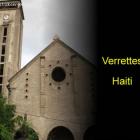 Verrettes, Haiti
  Marmelade, Haiti
 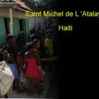 Saint Michel de L 'Atalaye
  Black Friday Shopping Season
 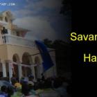 The Town of Savanette, Haiti